
Itinerary · Gran Canaria
Gran Canaria in 3 days
A 3-day Gran Canaria itinerary — Las Palmas and Las Canteras beach, the mountain interior and Roque Nublo, then the south from the Maspalomas dunes to Puerto de Mogán.
Published
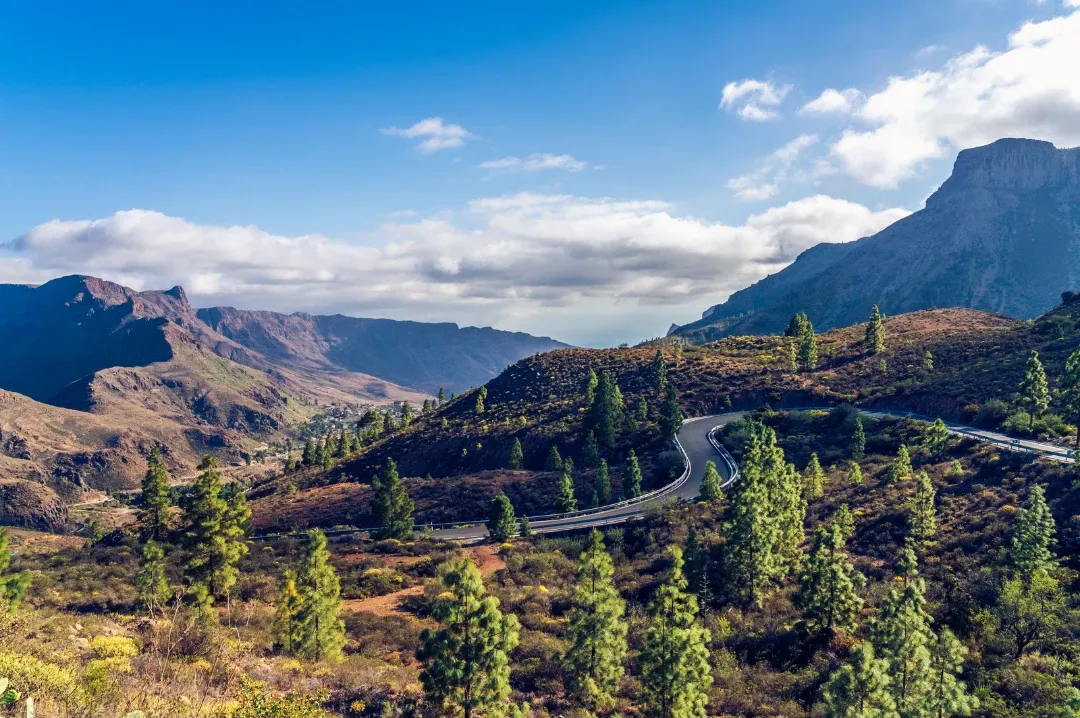
Three days is just enough to see the three sides of Gran Canaria: a capital with a city beach and an old town, volcanic peaks covered in pine forest, and a sunny south of dunes, lighthouses and harbours. This itinerary gives each one a day, at an easy pace, so you leave with a real feel for the island. And if you can stay a day longer, we finish with the north: Gáldar and Agaete.
Before you go. You’ll want a car for day two — the interior is all mountain roads and public transport is limited. If you’d rather not drive, organised tours cover the peaks. Days one and three are doable by bus on the island’s Global intercity network (locals call buses guaguas).
Day 1: Las Palmas de Gran Canaria
The capital is the perfect place to start: a lively city all year round, with history on every corner and one of the best-known city beaches in the Canary Islands.
Morning: Vegueta and Triana
Start in Vegueta, the district where the city was founded in 1478. Its cobbled streets and wooden-balconied houses hold the old town’s highlights:
- Santa Ana Cathedral, on the square of the same name. Its tower looks out over Vegueta’s rooftops and the sea.
- Casa de Colón, a museum about Columbus’s voyages and the Canary Islands’ ties with the Americas.
- Vegueta Market, for local produce and a coffee break.
Across the main road lies Triana, with its pedestrianised Calle Mayor, independent shops and modernist façades — a good spot for lunch.
On Google Maps: Santa Ana Cathedral (opens in a new tab)Casa de Colón (opens in a new tab)Vegueta Market (opens in a new tab)Calle Mayor de Triana (opens in a new tab)
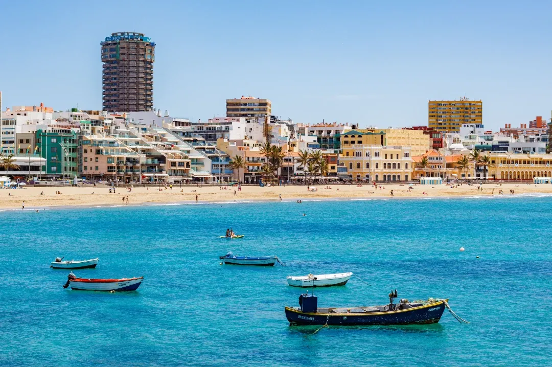
Afternoon: Las Canteras beach
Spend the afternoon at Las Canteras, a city beach around three kilometres long. A natural rock reef known as La Barra shelters much of it from the waves, leaving calm water. Stroll the promenade towards the Alfredo Kraus Auditorium and stay for sunset — on clear days you can see Mount Teide on neighbouring Tenerife.
Got extra time? The Bandama Caldera, a volcanic crater a short drive from the city, has a viewpoint looking down into the crater and out to the coast.
On Google Maps: Las Canteras beach (opens in a new tab)Bandama Caldera (opens in a new tab)
Day 2: the mountain interior
The centre of the island feels like another world: peaks, ravines, pine forests and villages high in the hills. Set off early, especially at weekends.
Arucas
On your way up into the hills, stop first in Arucas, surrounded by banana plantations. Its centre is dominated by the Church of San Juan Bautista, a striking neo-Gothic church built from volcanic stone. Arucas is also home to Arehucas rum.
On Google Maps: Church of San Juan Bautista, Arucas (opens in a new tab)
Teror
A few kilometres on is Teror, one of the island’s most traditional towns. Its main street, lined with wooden balconies, leads to the Basilica of Our Lady of the Pine, Gran Canaria’s patron saint. There’s a market on Sundays.
On Google Maps: Basilica of Our Lady of the Pine, Teror (opens in a new tab)
Pico de las Nieves and Roque Nublo
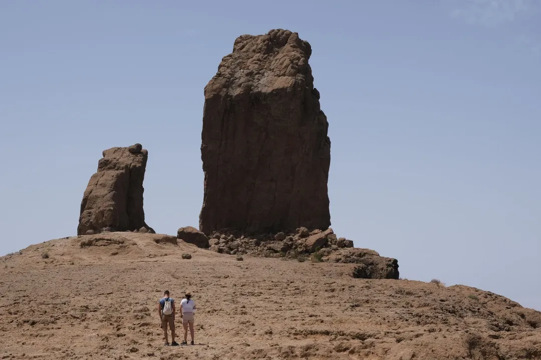
Next, head up to Pico de las Nieves, the highest point on Gran Canaria. From the viewpoint you can see Roque Nublo and, on a clear day, Mount Teide beyond.
Close by stands the island’s icon: Roque Nublo, a volcanic rock pinnacle right on the summit ridge. A short trail leads up from the La Goleta car park — allow around an hour there and back. The car park fills up early, so arrive in good time, and bring comfortable shoes and water.
On Google Maps: Pico de las Nieves (opens in a new tab)Roque Nublo (opens in a new tab)La Goleta car park (opens in a new tab)
Tejeda (and Artenara, if there’s time)
End the day in Tejeda, a whitewashed village overlooking the caldera, known for its almond sweets. If you have time, carry on to Artenara, the island’s highest municipality, famous for its cave houses. This whole area is part of the Risco Caído and the Sacred Mountains of Gran Canaria cultural landscape, a UNESCO World Heritage Site.
On Google Maps: Tejeda (opens in a new tab)Artenara (opens in a new tab)
Good to know: it’s usually cooler up in the mountains, and there can be cloud or wind even when the coast is sunny — pack an extra layer. The roads are very winding, so allow plenty of time.
Day 3: the south, from Maspalomas to Puerto de Mogán
Save the last day for the south, the sunniest part of the island.
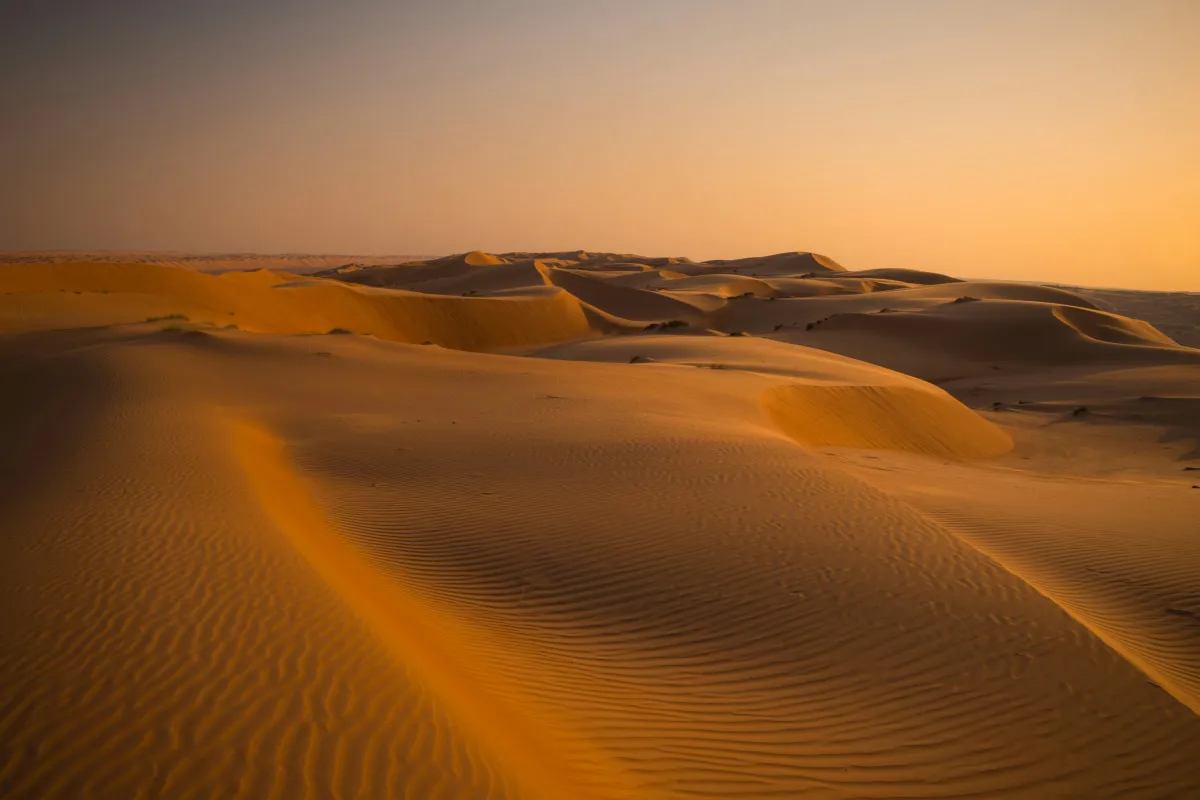
Morning: the Maspalomas dunes
Get to the Maspalomas dunes, a protected nature reserve by the sea, early: the light is softer and the heat easier to handle. Always stick to the marked paths — the dunes are fragile.
Then walk over to the Maspalomas lighthouse and the lagoon (la Charca), where you can spot birds. From there, the Meloneras promenade is perfect for a seaside stroll and lunch.
On Google Maps: Maspalomas dunes (opens in a new tab)Maspalomas lighthouse (opens in a new tab)Meloneras promenade (opens in a new tab)
Afternoon: Puerto de Mogán
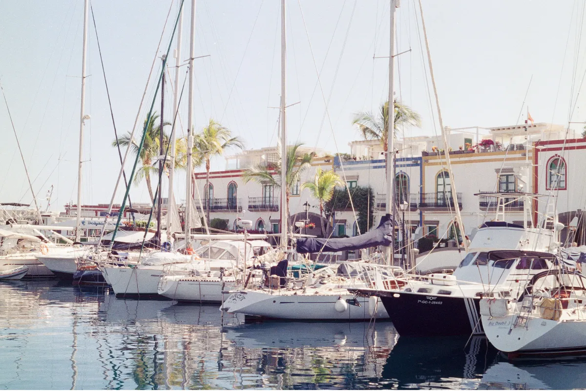
In the afternoon, head west to Puerto de Mogán, a small harbour village of canals, little bridges and whitewashed houses trimmed in bright colours and draped in bougainvillea. Wander its lanes and the quayside, then stay for dinner — it’s one of the most relaxed spots in the south to end your trip.
On Google Maps: Puerto de Mogán (opens in a new tab)
One more day? Head north
The north shows a quieter, less touristy side of the island: historic towns, banana plantations and a wilder Atlantic coastline.
Gáldar
Gáldar was the capital of the island’s indigenous people before the Castilian conquest. Don’t miss the Cueva Pintada Museum and Archaeological Park, a cave decorated with geometric paintings beside the remains of a pre-Hispanic village.
On Google Maps: Cueva Pintada, Gáldar (opens in a new tab)
Agaete and Puerto de las Nieves
Carry on to Agaete and its harbour, Puerto de las Nieves, a fishing port looking out over the cliffs of the west coast — a lovely spot for a seafood lunch. The natural rock pools of Las Salinas are close by, and inland, the Agaete Valley is one of the few places in Europe where coffee is grown.
On Google Maps: Puerto de las Nieves (opens in a new tab)Las Salinas rock pools, Agaete (opens in a new tab)Agaete Valley (opens in a new tab)
Good to know: whether you can swim in the rock pools depends on the sea. Only go in when it’s calm, and always follow local safety signs.
Where to stay for this itinerary
With only three days, it’s easiest to stick to one base:
- Las Palmas — for city life, a city beach and a local feel all year round. You’ll drive south on day three.
- The south (Maspalomas, Playa del Inglés or Meloneras) — for sunshine, beaches and pools. You’ll head up to the capital on day one.
- Puerto de Mogán — for a quieter atmosphere, though you’ll be further from the capital.
- The north (Arucas, Gáldar or Agaete) — for quiet towns and rural stays, close to the interior and the capital but further from the southern beaches.
The airport sits between the capital and the south, right by the motorway that links them, so any of these works well. You can compare each area on our Gran Canaria page.